



Jammu: The Southwest Monsoon has officially advanced across the entire meteorological subdivision of Jammu & Kashmir and Ladakh, with weather authorities warning of heavy rainfall, flash floods, landslides and localized cloudburst activity over the coming days.
According to the Meteorological Centre Srinagar, the monsoon covered the entire region on Wednesday, one day later than the normal onset date of June 30, marking a significant seasonal shift after prolonged heatwave conditions.
During the past 24 hours, widespread rainfall activity was recorded across parts of Jammu division, bringing relief from high temperatures but increasing weather-related risks in vulnerable areas.
The Meteorological Department (MeT) has forecast generally cloudy conditions with one or two spells of light to moderate rain or thundershowers at many places across Jammu and Kashmir from July 1 to July 4.
Heavy rainfall, brief intense showers, thunderstorms and gusty winds are likely at isolated locations during this period.
From July 5 to July 8, weather conditions are expected to remain generally hot and humid, accompanied by light to moderate rainfall and thundershowers at scattered to many places. Brief intense showers may continue at isolated locations, particularly in Jammu division.
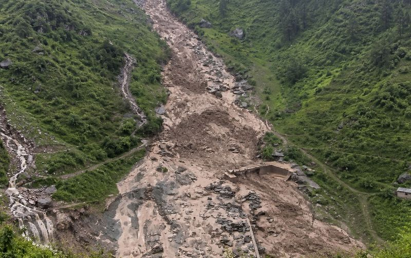
The department has warned that heavy rainfall and intense short-duration showers could trigger localized flash floods, landslides, mudslides and shooting stones in vulnerable areas of Jammu division, the Pir Panjal range, Chenab Valley and adjoining parts of South Kashmir.
Weather data released by IMD showed that Kashmir continued to experience above-normal temperatures despite changing weather patterns.
Srinagar recorded a maximum temperature of 35.2 degrees Celsius, nearly six degrees above normal, while Jammu recorded 36.3 degrees Celsius. Night temperatures also remained significantly above seasonal averages across several locations.
Rainfall recorded during the period included 35.8 mm in Jammu, 23.8 mm in Kathua, 12 mm in Katra, 19.6 mm in Rajouri and 5.4 mm in Bhaderwah.
Independent weather observer Faizan Arif said monsoon conditions are expected to intensify due to the interaction of multiple weak Western Disturbances over the region.
According to him, the first Western Disturbance currently affecting Jammu and Kashmir is expected to weaken by Thursday, while a second system is likely to arrive Thursday night and remain active till Saturday morning.
A third disturbance is forecast from Saturday afternoon through Sunday.
He said the combined influence of monsoon flow and successive Western Disturbances could increase the likelihood of moderate to heavy rainfall, short-duration intense showers and isolated cloudburst events.
Meanwhile, heavy rainfall triggered two cloudbursts in the Kalalgisar area of Bhalessa in Doda district on Wednesday, causing flash floods and debris flow that blocked several roads and disrupted connectivity to nearby villages.
Officials said authorities are monitoring the situation and restoration work will begin once weather conditions improve. Residents have been advised to avoid unnecessary movement in vulnerable areas.
Adverse weather conditions also disrupted religious pilgrimages in the region.
The district administration in Kishtwar suspended both the Machail Mata Yatra and Mindhal Mata Yatra on Wednesday due to continuous rainfall, slippery road conditions and the risk of shooting stones.
Pilgrims were advised not to undertake travel and remain at safe locations until further advisories are issued.
The Machail Mata Yatra, which began on April 14 after reopening of the shrine in Paddar Valley, has recorded around 90,000 devotees so far this year. The Mindhal Mata Yatra commenced on June 1 with the departure of the holy Charri from Balasu village to Mindhal Darbar in Himachal Pradesh.
The suspension comes less than a year after the devastating cloudburst in Chisoti village near the Machail route that caused widespread destruction and claimed dozens of lives.
The IMD has advised residents, tourists and pilgrims to remain updated through official weather bulletins and exercise caution, particularly in landslide-prone and flood-vulnerable zones over the next several days.

